Forschung
The project of the ‘Prehistoric Heraion’ includes both archaeological fieldwork and applications of interdisciplinary methods:
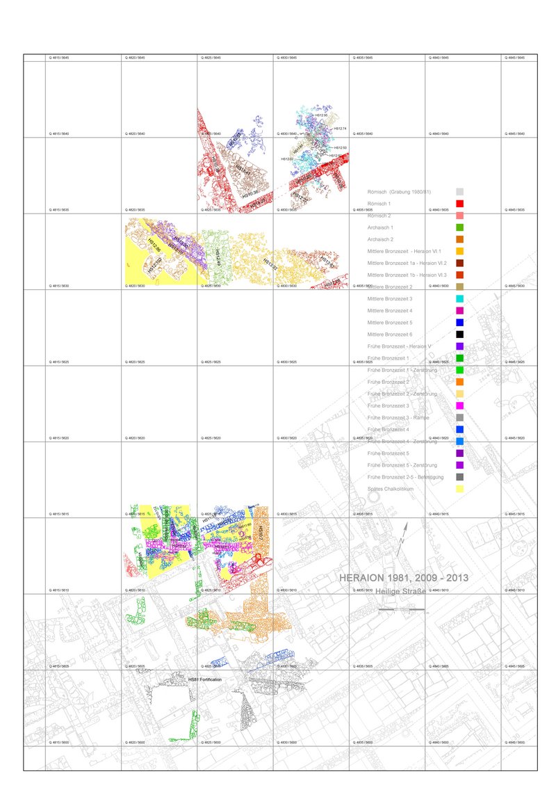
1. New Grid System of the site by fixing new points in the geodetical net, measuring and adjustment by a Total Station, incorporation of excavated architecture in the grid system (Dipl.-Ing. Hans Birk).
2. Geomagnetic prospection: Localization of architectural components in the area to be excavated, namely north of the Sacred Road, as well as outside of the Hera sanctuary for the localization of the Bronze Age cemetery (Dr. Harald Stümpel and Dr. Christina Klein, Institute for Geophysics, University of Kiel, Germany).
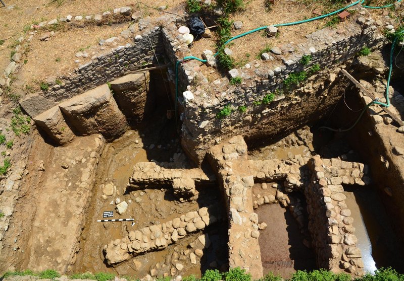
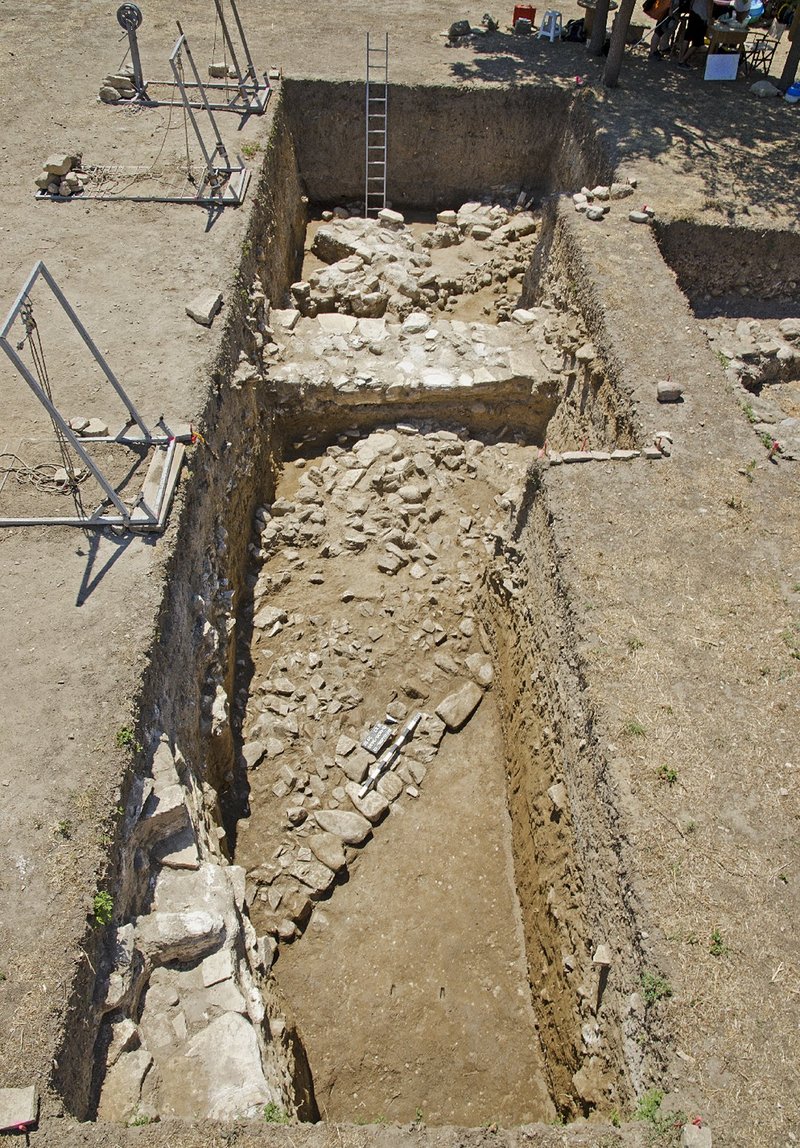
3. Archaeological excavation north of the Sacred Road (stratigraphic excavation, conventional and digital architectural plans, digital photographing). Due to the high water table and the permanent use of pumps only relative small areas can be excavated, so that their investigation up to the virgin soil can be completed in two or at the latest in three seasons.
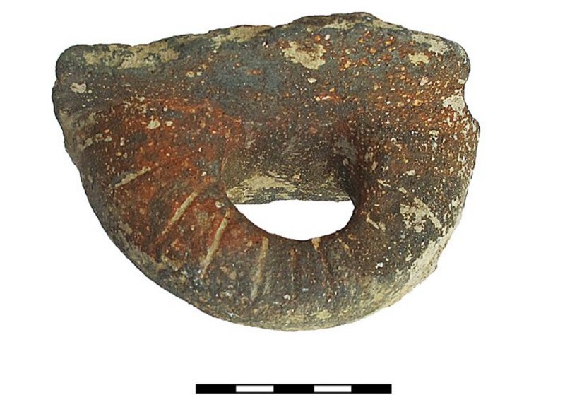
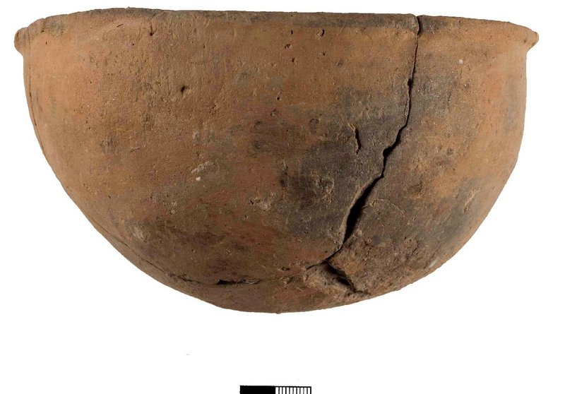
4. Study of archaeological finds (catalogue, cleaning, restauration, drawing, and description in the data base of AIAS PRO software).
5. Preparation of digital plans using the AutoCAD Map 3D and by data bases using the software AIAS PRO.
6. Archaeozoology (study of the animal remains – Prof. Dr. N. Benecke, German Archaeological Institute).
7. Archaeobotany (study of the botanical remains – Assist. Prof. Evi Margaritis, The Cyprus Institute).
8. Anthracology (study of carbonized wood remains – PhD. cand. Antigoni Mavromati, University of Valencia).
9. Radiocarbon dating/Dendrochronology (dating of organic burnt materials, such as wood, seeds, and of animal bones at the National Research Center of Natural Sciences ‘Demokritos’ – Laboratory for Archaeometry-Dr. Y. Maniatis, and at Malcolm and Carolyn Wiener Dendrochronology Laboratory at Ithaca University - Prof. St. Manning).
10. Metallurgy (application of archaeometric methods, such as RFA, ICP, MC and MS, for estimating the composition of metal finds and for locating the metal sources).
11. Petrographic analysis, Neutron Activation Analysis (NAA) and Scanning Electron Microscopy (SEM) for ceramics (Dr. Sergios Menelaou, University of Sheffield; Fitch Laboratory of the British School at Athens).
12. Geological identification of raw materials (Emer. Prof. Nikos Skarpelis, Economic Geology, University of Athens).
13. Lithic technology (Assoc. Prof. Neyir Kolankaya-Bostancı, Hacettepe University, Ankara).
14. Polished stone technology (Dr. Athina Boleti, University of Paris I).
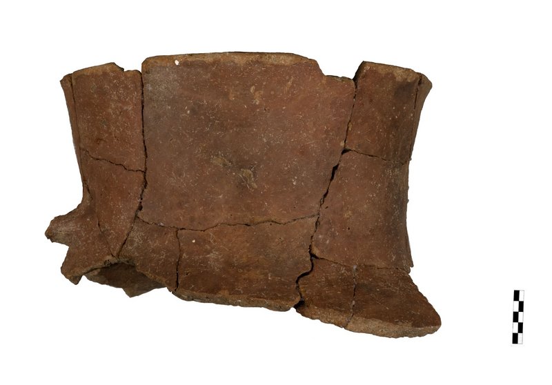
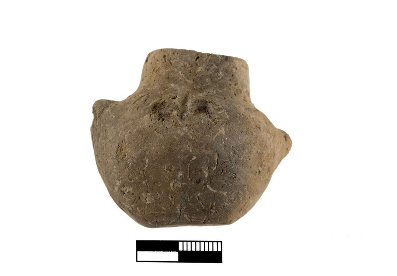
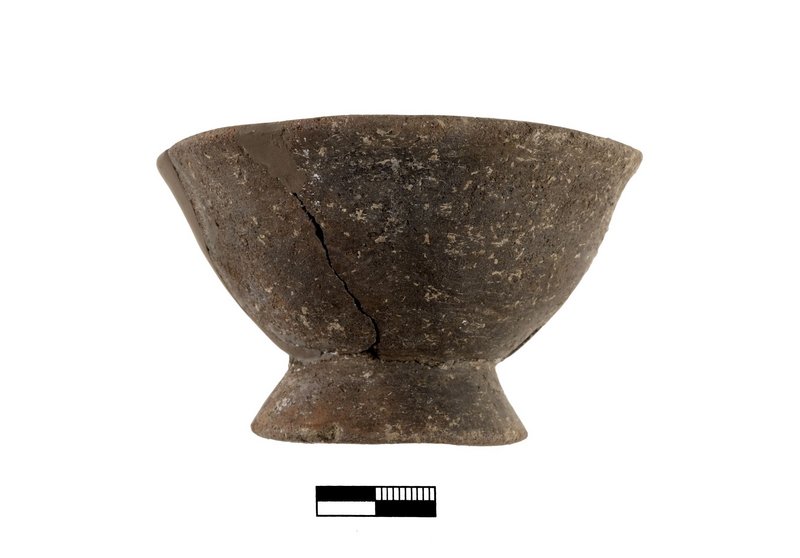
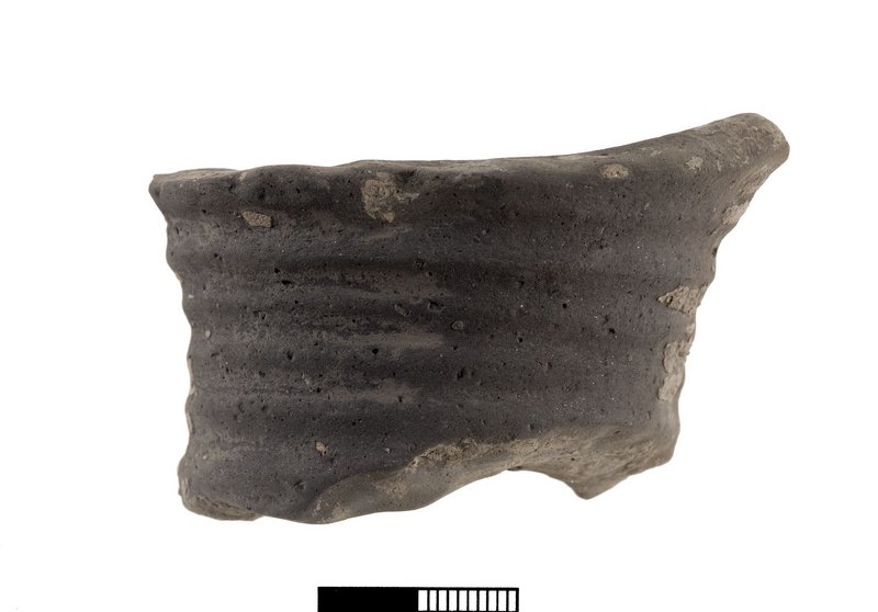
15. Systematic study of the pottery and small finds deriving from the excavations of 2009-2013 (Ou. Kouka, S. Menelaou, G. Bourogiannis, K. Ragkou, S. Vakirtzi, A. Boleti, N. Kolankaya- Bostancı). The study seasons (2014-2010) included a detailed study of pottery groups, as well as restauration (G. Papagrigoriou), cataloguing, drawing (A. Kontonis, Chr. Kolb), professional photographing (Chr. Papanikolopoulos) and sampling for scientific analysis. Small finds will be also catalogued, drawn and photographed. A first statistic of all excavated pottery groups, as well as restauration and documentation (catalogue/description, drawing and photograph) of the most important ceramic and small finds has been undertaken.
16. Verification of data with the use of the soft ware AIAS PRO. This soft ware is available at the Laboratory for Archiving and Publishing of Archaeological Projects of the Archaeological Research Unit of the University of Cyprus (Laboratory Leader: Prof. Dr. Ourania Kouka) and serves to the combination of digital plans and data bases in order to conduct a qualitative, quantitative analysis of finds, to produce distribution maps of various finds in the successive phases and to conclude for the function of spaces and the various economic activities of the successive settlements.
17. 3D digital reconstruction of the Early Bronze Age settlement North of the Sacred Road (Angeliki Chalkia, MA University of Cyprus).
18. Simulation Model of the of the Early Bronze Age with use of Blender, Autodesk 3ds Max and Unity (Markos Panagiotou, MA University of Cyprus).
Heraion is located on the southern coast of the island of Samos, in the biggest, most fruitful, and best-watered plain of the island, which was the only micro-region suitable for habitation from the Neolithic Period through the Late Antiquity. Prehistoric habitation on Samos goes back to the Late and Final Neolithic (LN, FN) as stratified levels at the promontory of Kastro-Tigani, 7 km east of Heraion, demonstrate. Stratified Early Bronze Age (EB) habitation has been documented at Kastro-Tigani and at Heraion. The Middle (MB) and the Late Bronze Ages (LB) are known through stray finds at Heraion, Fanari and Mesokampos and through late Mycenaean chamber tombs at Heraion and Myloi.
Excavations conducted by Milojčić (1950’s), Isler and Walter (1960’s) in the area of Hera Temple have revealed a flourishing EB settlement with early urban characteristics, dating in the late EB II-EBIII periods (2500/2450-2000 BC, Heraion I-V). From the MB (Heraion V) and the LB (Heraion VI) only a few stray finds and a grave have been reported. Earlier EB material has been identified 1981 below the Roman settlement located north of the Sacred Road.
BIBLIOGRAPHY OF THE OLD EXCAVATIONS
Milojčić, V. 1961. Die prähistorische Siedlung unter dem Heraion: Grabung 1953 und 1955. Samos Band I. Bonn: Rudolf Habelt.
Isler, H.-P. 1973. “An Early Bronze Age Settlement on Samos.” Archaeology 26:170–175.
Kyrieleis, H., H.J. Kienast, and H.-J. Weisshaar. 1985. “Ausgrabungen im Heraion von Samos 1980/81.” AA 100:365–418.
The main goals of the project can be summarized as follows: a) to investigate the possible existence of the Neolithic-Chalcolithic, the early phases of the Early Bronze, the Middle and Late Bronze Age settlement phases, b) to examine the spatial distribution of economic activities through all phases, c) to study the external contacts of these settlements, d) to diagnose the political and social organization and their changes through time, e) to illuminate early urbanism process in the Early and the Middle Bronze Age, and f) to testify the participation and the specific role of Samos in local and extensive trade networks not only within the Aegean, but also between the Aegean and Western Anatolia, as well as between the Aegean and the Eastern Mediterranean including Cyprus in Prehistoric Times.